|
|
|
Advertisements:
GeographyLocation
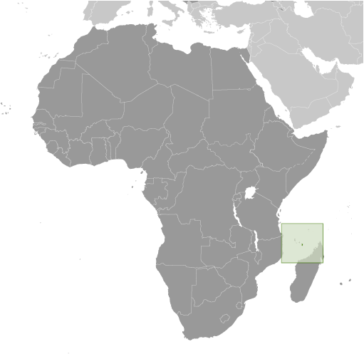
Southern Indian Ocean, island in the Mozambique Channel, about half way between northern Madagascar and northern Mozambique Geographic coordinates
12 50 S, 45 10 E
Map references
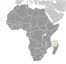
Africa
Area World Ranking: 204
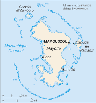
Total 374 sq km
Land 374 sq km Water 0 sq km Area - comparative
Slightly more than twice the size of Washington, DC Land boundaries
0 km
Coastline
185.2 km
Maritime claims
Territorial sea 12 nm
Exclusive economic zone 200 nm Climate
Tropical; marine; hot, humid, rainy season during northeastern monsoon (November to May); dry season is cooler (May to November) Terrain
Generally undulating, with deep ravines and ancient volcanic peaks Elevation extremes
Lowest point Indian Ocean 0 m
Highest point Mlima Benara 660 m Natural resources
NEGL
Land use
Arable land NA%
Permanent crops NA% Other NA% Irrigated land
NA
Natural hazards
Cyclones during rainy season
Environment - current issues
NA
Geography - note
Part of Comoro Archipelago (18 islands)
Comments
Add a new comment: |
Advertisement
Members area
Mayotte [ France ] (Overseas Territory):
GPS points from Mayotte [ France ] (Overseas Territory)
|
||||||||
 Mayotte was ceded to France along with the other islands of the Comoros group in 1843. It was the only island in the archipelago that voted in 1974 to retain its link with France and forego independence. In March 2009, Mayotte voted overwhelmingly to become France's 101st department - and fifth overseas department - a change scheduled to become official in 2011.